Tuesday, 3 July 2012

PowerPro Depth-Hunter

PowerPro Depth-Hunter

Introducing a new metered-line called Depth-Hunter from PowerPro. There are 4-colors (Blue/Yellow/Green/Orange), with 25 feet of color per segment. There is also a black tic marking every 5 feet for accurate and instant depth measurement. This allows you to present your lure in the strike zone easily, accurately and repeatedly. This is only available from PowerPro.
  • PowerPro Enhanced Body Technology ™ with multiple-color dying process
  • 4 – Color (Blue/Yellow/Green/Orange),
  • 25ft per color = 100ft/4-color. Color repeats every 100 feet
  • 2” Black hash or tick marking every 5ft- for precise lure depth placement
  • Available sizes : 10lb, 15lb, 20lb, 30lb, 40lb, 50lb, 65lb, 80lb, 100lb, & 150lb
  • Available length : 500ft, 1000ft, 1500ft, 4500ft, 9000ft


Article Source:  http://www.powerpro.com/

Monday, 2 July 2012

Cobia

Cobia

From Wikipedia, the free encyclopedia
(Redirected from Rachycentridae)
Jump to: navigation, search
Cobia
Scientific classification
Kingdom:Animalia
Phylum:Chordata
Class:Actinopterygii
Order:Perciformes
Family:Rachycentridae
Genus:Rachycentron
Kaup, 1826
Species:R. canadum
Binomial name
Rachycentron canadum
(Linnaeus, 1766)
Cobia (Rachycentron canadum)—also known as black kingfish, black salmon, ling, lemonfish, crabeaters, aruan tasek, etc.—are perciform marine fish, the sole representative of their family, the Rachycentridae.


 Description

Attaining a maximum length of 2 metres (78 inches) and maximum weight of 68 kilograms (150 pounds), cobia have elongate fusiform (spindle shaped) bodies and broad, flattened heads. Their eyes are small and their lower jaw projects slightly past the upper jaw. On the jaws, tongue and roof of the mouth are bands of villiform (fibrous) teeth. Their bodies are smooth with small scales, their dark brown coloration grading to white on the belly with two darker brown horizontal bands on the flanks. These may not be prominent except during spawning when cobia lighten in colour and adopt a more prominently striped pattern. The large pectoral fins are normally carried horizontally (rather than vertically as shown for convenience in the illustration), so that, as seen in the water they may be mistaken for a small shark. When boated, the horizontal pectoral fins enable the cobia to remain upright so that their vigorous thrashing can make them a hazard. The first dorsal fin is composed of six to nine independent, short, stout, and sharp spines. The family name Rachycentridae, from the Greek words rhachis meaning "spine" and kentron meaning "sting," is an allusion to these dorsal spines. Mature cobia have forked, slightly lunate tail fins with most fins being a dark brown. They lack air bladders.

 Similar species

A Cobia at an aquarium, showing the horizontal pectoral fins and broad head
Cobia somewhat resemble and are most closely related to the Remora of the family Echeneidae. However, they lack the dorsal sucker of the Remora, their body is far stouter and their tail is far more developed, and forked instead of rounded. Juvenile cobia are patterned with conspicuous bands of black and white. Their tails are rounded rather than forked as in the adults.

 Distribution and habitat

Cobia are pelagic and are normally solitary except for annual spawning aggregations; however, they will congregate at reefs, wrecks, harbours, buoys and other structural oases. They may also enter estuaries and mangroves in search of prey.
They are found in warm-temperate to tropical waters of the West and East Atlantic, throughout the Caribbean and in the Indo-Pacific off India, Australia and Japan.[1] The largest taken on rod & reel was taken from Shark Bay, Australia weighing 60 kg (135 lb). They are able to tolerate a wide range of temperatures (eurythermal) and salinity (euryhaline) between 1.6 and 32.2°C and 5-44.5 ppt in the environment.[2]

 Feeding habits

Cobia feed primarily on crabs, squid, and other fish. Cobia will follow larger animals such as sharks, turtles and manta rays in hope of scavenging a meal. Cobia are intensely curious fish and show no fear of boats and are known to follow other caught fish up to a boat and linger to see the action. Their predators are not well documented, but the dolphinfish (Coryphaena hippurus) is known to feed on immature cobia. Shortfin mako sharks are known to feed on adult cobia and have been seen by fishermen following cobia during their annual springtime migration in the northern Gulf of Mexico.

 Life history

Cobia are pelagic spawners; that is, they release many tiny (1.2 mm) buoyant eggs into the water which become part of the plankton. The eggs float freely with the currents until hatching. The larvae are also planktonic, being more or less helpless during their first week until the eyes and mouths develop. Males mature at two years and females at three years. Both sexes lead moderately long lives of 15 years or more. Spawning takes place diurnally from April to September in large offshore congregations where females are capable of spawning up to 30 times during the season.[3] Up to 20 individual spawns may take place in one season, with intervals of about one to two weeks. Cobia are frequently parasitized by nematodes, trematodes, cestodes, copepods and acanthocephalans.

 Migration patterns

Cobia make seasonal migrations along the coasts in search of water in their preferred temperature range. Wintering in the Gulf of Mexico, they migrate north as far as Maryland in the Summer, passing East Central Florida in March.

 Utilization

Cobia are sold commercially, and command a high price for their firm texture and excellent flavor. However, there is no directed fishery owing to their solitary nature. They have been farmed in aquaculture for this reason. The meat is usually sold fresh. They are typically served in the form of grilled or poached fillets. Chefs Jamie Oliver and Mario Batali each cooked several dishes made with cobia in the "Battle Cobia" episode of the Food Network program Iron Chef America, which first Aquaculture
Cobia fingerlings in aquaculture
Cobia, Rachycentron canadum, is considered one of the most suitable candidates for warm, open-water marine fish aquaculture in the world.[5][6] Their rapid growth rate in aquaculture, as well as the high quality of the flesh makes cobia potentially one of the most important marine fish for future aquaculture production.[7]
Currently, cobia are being cultured in nurseries and grow-out offshore cages many parts of Asia and off the coast of US, Mexico and Panama. In Taiwan 100–600 g cobia are cultured for 1–1.5 years to reach 6–8 kg in size which is suitable for export to Japan. Currently, around 80% of marine cages in Taiwan are devoted to cobia culture.[6] In 2004, FAO reported that 80.6% of the world’s cobia production was by primarily China and Taiwan.FAO After China and Taiwan, Vietnam is the third largest producer of farmed cobia in the world where production was estimated at 1500 tonnes in 2008.[6] Following the success of cobia aquaculture in Taiwan, emerging technology is being used to demonstrate the viability of raising hatchery-reared cobia in collaboration with the private sector primarily using SeaStation™ and Aquapod™ submerged cages at exposed offshore sites in Puerto Rico and the Bahamas.[8]
Greater depths, stronger currents and distance from shore all act to reduce environmental impacts often associated with fin fish aquaculture. Offshore cage systems could become some of the most environmentally sustainable methods for commercial marine fish aquaculture.[9] However, some problems still exist in cobia culture that need to be addressed and solved for increasing production. These include high mortality due to stress during transport from nursery tanks or inshore cages out to grow-out cages, along with diseases during nursery and growout culture resulting

Extreme Fishing With Robson Green Season 2 Episode 7

Striped bass

Striped bass

 
Striped bass
Striped bass
Scientific classification
Kingdom:Animalia
Phylum:Chordata
Class:Actinopterygii
Order:Perciformes
Family:Moronidae
Genus:Morone
Species:M. saxatilis
Binomial name
Morone saxatilis
(Walbaum, 1792)
The striped bass (Morone saxatilis), also called Atlantic striped bass, striper, linesider, rock, pimpfish, or rockfish) is the state fish of Maryland, Rhode Island, South Carolina, and the state saltwater (marine) fish of New York, New Jersey, Virginia, and New Hampshire. They are also found in the Minas Basin and Gaspereau River in Nova Scotia, Canada.


 Morphology and lifespan

The striped bass is a typical member of the Moronidae family in shape, having a streamlined, silvery body marked with longitudinal dark stripes running from behind the gills to the base of the tail. Maximum size is 200 cm (6.6 ft) and maximum scientifically recorded weight 57 kg (125 US pounds). Common mature size is 120 cm (3.9 ft). Striped bass are believed to live for up to 30 years.[1]

 Distribution

 Natural distribution

Striped bass are native to the Atlantic coastline of North America from the St. Lawrence River into the Gulf of Mexico to approximately Louisiana. They are anadromous fish that migrate between fresh and salt water. Spawning takes place in fresh water.

 Introductions outside their natural range

Striped bass have been introduced to the Pacific Coast of North America and into many of the large reservoir impoundments across the United States by state game and fish commissions for the purposes of recreational fishing and as a predator to control populations of gizzard shad.[2][3][4] These include: Elephant Butte Lake in New Mexico; Lake Ouachita, Lake Norfork, Beaver Lake (Arkansas) and Lake Hamilton in Arkansas; Lake Powell, Lake Pleasant, and Lake Havasu in Arizona; Castaic Lake, Lake George in Florida, Pyramid Lake, Silverwood Lake, Diamond Valley Lake, East Fork State Park Lake near Cincinnati Lewis Smith Lake in Alabama [1], Lake Cumberland, and Lake Murray in California; Lake Lanier in Georgia; Reelfoot Lake, Tennessee; and Lake Mead, Nevada; Lake Texoma, Lake Tawakoni, Lake Whitney, Possum Kingdom Lake, and Lake Buchanan in Texas; Raystown Lake in Pennsylvania; and in Virginia Smith Mountain Lake.[5]
Striped bass have also been introduced into waters in Ecuador, Iran, Latvia, Mexico, Russia, South Africa, and Turkey primarily for sport fishing and aquaculture.[1]

 Environmental factors

The spawning success of striped bass has been studied in the San Francisco Bay-Delta water system, with a finding that high total dissolved solids (TDS) reduce spawning. At levels as low as 200 mg/L TDS there is an observable diminution of spawning productivity.[6] They can be found in lakes, ponds, streams and wetlands.
Former President of the United States George W. Bush, in Executive Order 13449 of October 20, 2007, designated the striped bass as a protected game fish. Further, he directed executive agencies to use existing legal authorities, to the extent possible, to prohibit the sale of striped bass caught in Federal waters in the Atlantic Ocean and Gulf of Mexico.[7]

 Life cycle

Illustration of a group of striped bass
Striped bass spawn in freshwater and although they have been successfully adapted to freshwater habitat, they naturally spend their adult lives in saltwater (i.e., it is anadromous). Four important bodies of water with breeding stocks of striped bass are: Chesapeake Bay, Massachusetts Bay/Cape Cod, Hudson River and Delaware River. It is believed that many of the rivers and tributaries that emptied into the Atlantic, had at one time, breeding stock of striped bass. One of the largest breeding areas is the Chesapeake Bay, where populations from Chesapeake and Delaware bays have intermingled.[8] There are very few successful spawning populations of freshwater striped bass, including Lake Texoma, the Colorado River and its reservoirs downstream from and including Lake Powell, and the Arkansas River as well as Lake Marion (South Carolina) that retained a landlocked breeding population when the dam was built; other freshwater fisheries must be restocked with hatchery-produced fish annually. Stocking of striped bass was discontinued at Lake Mead in 1973 once natural reproduction was verified.[9]

 Hybrids with other bass

Striped bass have also been hybridized with white bass to produce hybrid striped bass also known as wiper. These hybrids have been stocked in many freshwater areas across the U.S.[10][11]

 Fishing for striped bass

Striped bass caught in the Atlantic Ocean off the New Jersey coast.
Striped bass are of significant value as sport fishing, and have been introduced to many waterways outside their natural range. A variety of angling methods are used, including trolling and surfcasting, with top water lures a good pick for surf casting. Striped bass will take a number of live and fresh baits including bunker, clams, eels, sandworms, herring, bloodworms, mackerel, and shad, with the last being an excellent bait for freshwater fishing.
The largest striped bass ever taken by angling was a 81.88 lb (37.14 kg) specimen taken from boat in Long Island Sound, near the Outer Southwest Reef, off the coast of Westbrook, Connecticut. The all-tackle world record fish was taken by Gregory Myerson[12] on the night of August 4, 2011. The fish took a drifted live eel bait, and fought for 20 minutes before being boated by Myerson. A second hook and leader was discovered in the fish's mouth when it was boated, indicating it had been previously hooked by another angler. The fish measured 54 inches in length and had a girth of 36 inches. The International Game Fish Association declared Myerson's catch the new All-Tackle World Record striped bass on October 19, 2011.[13] In addition to now holding the All-Tackle record, Meyerson’s catch also landed him the new IGFA men’s 37 kg (80 lb) line class record for striped bass, which previously stood at 70 lb. The previous all-tackle world record fish that was unseated by Myerson's 81.88 pound fish was a 35.6 kg (78.5 lb) specimen taken in Atlantic City, New Jersey on September 21, 1982[14] by Albert McReynolds, who fought the fish from the beach for an hour and twenty-minutes after taking his Rebel artificial lure. McReynolds all-tackle world record stood for 29 years.[15]
Recreational bag limits vary by state and province.

 Landlocked striped bass

Striped bass are an anadromous fish and their spawning ritual of traveling up rivers to spawn led some of them to become landlocked during lake dam constructions. It is now documented that the first area they became landlocked was in the Santee-Cooper river during the construction of the two dams that impounded Lake Moultrie and Lake Marion, and because of this the state game fish of South Carolina is the striped bass.[16]
Recently biologists believe that striped bass stayed in rivers for long periods of time, some not returning to sea unless temperature changes forced migration. Once fishermen and biologists caught on to rising striped bass populations, many state natural resources departments started stocking striped bass in local lakes. Striped bass still continue the natural spawn run in freshwater lakes, traveling up river and blocked at the next dam, which is why they are landlocked. Landlocked stripers have a hard time reproducing naturally, and one of the few and most successful rivers they have been documented reproducing successfully is the Coosa River in Alabama and Georgia.[17]
One of the only landlocked striped bass populations in Canada, is located in the Grand Lake, Nova Scotia. They migrate out in early April into the Shubencadie river to spawn. These bass also spawn in the Stewiacke river (tributary of the Shubencadie river). The Shubencadie river system is one of five known spawning areas in Canada for Striped bass. The others being St. Lawerence river, Mirmichi River, St John river, Annapolis river and Shubencadie/Stewiacke rivers. http://www.dfo-mpo.gc.ca/species-especes/species-especes/stripedbass-Fundy-barraye-eng.htm

 Management

The striped bass population declined to less than 5 million by 1982, but efforts by fishermen and management programs to rebuild the stock proved successful, and in 2007, there were nearly 56 million fish, including all ages. Recreational anglers and commercial fisherman caught an unprecedented 3.8 million fish in 2006. The management of the species includes size limits, commercial quotas, and biological reference points for the health of the species. The Atlantic States Marine Fisheries Commission states that striped bass are "Not overfished and overfishing is not occurring."[18]

393.8kg Blue Marlin caught at Mercury Bay

393.8kg Blue Marlin caught at Mercury Bay

By Grant Blair 10/02/2011

A 393kg blue marlin was caught yesterday by 72yr old local fishing legend, Mick Ellwood. Mick was fishing on board the 60' Riviera with an experienced and seasoned crew including owner, Vern Heydon, and Mick's son Bruce when the marlin was hooked. After a torrid 6 hour battle the marlin was bought aboard.
Mick and family are well established fisho's in the area and Mick owned and ran the charter vessel, 'The Whai' for many years. The Whai is now run by his son John and Bruce fishes crayfish quota in the area.
Vern, and 'The Immigrant' are no strangers to notable blue marlin captures however no doubt this is the highlight of their time on the water. The Immigrant' certainly can raise fish - it's first marlin was caught and released on the delivery trip on the run up the coast after being unloaded - a 183kg blue!
Vessel: "The Immigrant '
Owner: Vern Heydon
Skipper: Bruce Ellwood
Angler: Mick Ellwood
Species: Blue Marlin
Weight:: 393.8 kgs
Lineweight:: 37kg
Time: 6 hrs

Marion Bay, South Australia

Fishing Destination

Marion Bay, South Australia

 
Marion Bay
South Australia
MarionBayJetty.JPG
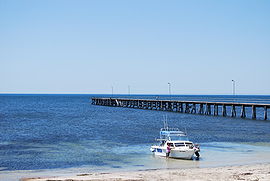
Jetty at Marion Bay
Marion Bay is located in South Australia
Marion Bay
Population:138 (2006 Census)[1]
Established:1872
Postcode:5576
LGA:District Council of Yorke Peninsula
State electorate:Goyder
Federal Division:Grey
Marion Bay is a small township at the southern tip of the Yorke Peninsula in South Australia, Australia. At the 2006 census, Marion Bay had a population of 138.[1]
It is surrounded by beaches and is the gateway to the Innes National Park. The close proximity of the beach and cliffs have popularized Marion Bay as a fishing destination, with Brown Beach in the nearby Innes National Park being particularly famous among recreational fisherman as a picturesque fishing destination.
Two very popular surfing resorts are Ethel Wreck and Pondalowie Bay.

 Notes and references

 External links

Photo

Huge Fish makes man his girlfriend! Chew On This

Gansbaai

Fishing Destination

Gansbaai

 
Gansbaai
Danger Point lighthouse near Gansbaai
Gansbaai is located in Western Cape
Gansbaai
Location in the Western Cape
Gansbaai is located in South Africa
Gansbaai
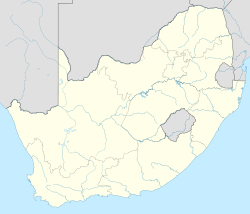
Gansbaai shown within South Africa
Coordinates: 34°34′58″S 19°21′8″E / 34.58278°S 19.35222°E / -34.58278; 19.35222Coordinates: 34°34′58″S 19°21′8″E / 34.58278°S 19.35222°E / -34.58278; 19.35222
CountrySouth Africa
ProvinceWestern Cape
DistrictOverberg
MunicipalityOverstrand
Area[1]
• Total7.33 km2 (2.83 sq mi)
Population (2001)[1]
• Total4,770
• Density650/km2 (1,700/sq mi)
Racial makeup (2001)[1]
Black African2.3%
Coloured51.2%
White46.5%
First languages (2001)[1]
Afrikaans94.2%
English4.8%
Other1%
Time zoneSAST (UTC+2)
Postal code7220
Area code028
Gansbaai (Afrikaans: "bay of geese," sometimes referred to as Gans Bay) is a fishing village and popular tourist destination in the Overberg District Municipality, Western Cape, South Africa. It is known for its dense population of Great White Sharks and as a whale-watching location.
The main tourist attraction in Gansbaai since approximately 1995 has been cage diving with Great White sharks. It is said[who?] that after Kruger National Park, the Great White sharks attract some of the highest number of tourist to South Africa for any singular activity.

 History

Gansbaai at De Kelders has one of the oldest associations with man in the world. At the time when Neanderthal man was still the dominant species of genus Homo in Europe, a group of modern people (Homo sapiens sapiens) had already made Klipgat Cave their home. Remains have been excavated showing modern man living here more than 70,000 years ago.[citation needed] Klipgat Cave is located in the Walker Bay Nature Reserve, next to De Kelders, the residential shore area of Gansbaai. As one of only three places in South Africa where such old remains have been excavated, Klipgat Cave is one of the most important historical sites in the Western Cape. The reserve and the cave are open to the public.
The earliest evidence of the presence of sheep-herding Khoi people (after the hunter-gatherer-"San", the original indigenous population of the Western Cape) in the Western Cape has been found in Klipgat Cave as well. Until the arrival of the first white settlers at the end of the 18th century, the Khoi people thrived in this region. An expedition sent by Jan van Riebeeck to the area, described meeting people of the so-called Chainouqua-tribe near Baardskeerdersbos, a rural hamlet, 15 kilometres (9.3 mi) from Gansbaai. The river flowing through the Baardskeerdersbos Valley is still called "Boesmansrivier" (Afrikaans for Bushman's river). "Bushman" is a name commonly used the for San-people, but will in this case have reflected Khoi-people.
It was people of Khoi-descent that erected the first permanent settlement in the Gansbaai vicinity. In 1811 fishing-cottages were built at Stanfords Bay in De Kelders.
The first white settlers in the area were "trekboere" (nomadic farmers). They copied the Khoi herding techniques of using a grazing area until it was exhausted, then moving on to greener pastures. The area was big and fertile enough for such purposes. On many of the large farms around Gansbaai, the old and original homesteads and mudstone-houses tell of the days that the white farmers settled down.
Plaque commemorating the sinking of the Birkenhead, affixed to the Danger Point lighthouse.
The troopship HMS Birkenhead was wrecked off Danger Point in 1852. A barely visible rock 2 kilometres (1.2 mi) from Danger Point (now aptly called "Birkenhead Rock") was fatal for the troopship carrying young Welsh and Scottish soldiers and their officers and family on their way to Eastern Cape to fight the Xhosa. The Birkenhead became famous because it was the first shipwreck where the "women and children first" protocol was applied. All women and children were saved; most of the men perished. Most of the horses swam ashore and were the ancestors of a feral herd that roamed the plains east of Gansbaai until late in the 20th century.[citation needed]
More than 140 ships have been wrecked and thousands of lives lost between Danger Point and Cape Infanta, to the east of Gansbaai. In 1895, the Danger Point Lighthouse was built, providing more security for the ships in these dangerous waters.
Gansbaai was founded in 1881 after 18-year-old fisherman Johannes Cornelis Wessels walked there across the dunes from Stanford and discovered excellent fishing in the area. He settled there, and soon after other families followed suit. Up until the late 20th century, however, it was little more than a primitive fishing village due to its isolation and lack of communication with the outside world.
Gansbaai's economy received an economic boost in 1939 when a small factory was built to process sharks' livers for Vitamin A and lubricant, which was in great demand during World War II. After the war, however, demand fell and the few short years of prosperity were over.
It wasn't until local school principal Johannes Barnard persuaded village fishermen to set up the first Fishery Cooperative in South Africa that the economy began to recover. Barnard helped the fishermen obtain capital from the Fisheries Development Corporation, deepen the harbour and establish a modern fish meal factory. The town became a municipality in 1963.
Today, Gansbaai's economy still revolves around its fishing industry, but an increasingly large part of it now comes from tourism. It is considered[who?] the Great White Shark capital of the world, drawing National Geographic Society film crews and researchers from around the globe to study the wildlife. It has also become a popular whale-watching spot for the Southern Right Whale.
The Southern Right Whale can be seen in large numbers, especially from the rocky shores of De Kelders on Walker Bay. This is also the site of an old whaling station. The lookout platform and the steps leading to it are still standing. Today whales are protected in South Afric and the descendants of the whalers are now the skippers on the boats that take tourists out for boat-based whale watching.
The hinterland is known for its vast mountainous landscapes covered with unspoilt vegetation of the Cape Floral Kingdom ('fynbos'). Despite being the smallest of the world's six floral kingdoms, the Cape Floral Kingdom, with 9000 species, is the richest.[citation needed]

 Dyer Island, Geyser Rock and Shark Alley

The original name of Dyer Island was Ilha da Fera (Island of wild creatures), so named by Portuguese seafarers in the 15th century.
Dyer Island is the largest of a group of islands about 5 miles (8.0 km) offshore from Gansbaai and less than that from Danger Point peninsula. It is named after Samson Dyer, an emigrant from the USA to the Cape Colony in 1806, who lived on the island collecting guano, which he sold to mainlanders as fertilizer. The island is home to thousands of African Penguins.
Geyser Rock is a smaller island nearby, and is home to around 60,000 Cape Fur Seals.
The shallow channel between the two islands is popularly known as "Shark Alley".
Dyer Island is a nature reserve and cannot be accessed by the general public, but boat tours leave from Kleinbaai on Danger Point peninsula to watch whales, stop at a shark-diving-boat, to cross Shark-Alley and to go around Dyer Island.

 Government

Gansbaai is located in the Overstrand Local Municipality, which falls within the Overberg District Municipality. The Overstrand council governs the southwestern coast of the Overberg, from Pringle Bay to Pearly Beach; its headquarters are in Hermanus but there is an office in Gansbaai.[2]

 Demographics

In the 2001 census, the population of Gansbaai (including the adjacent township of Masakhane) was recorded as 6,969 people, living in an area of 12.2 square kilometres (4.7 sq mi), giving the town a population density of 572.9 inhabitants per square kilometre (1,484 /sq mi).[3] 35% of the inhabitants described themselves as "Coloured", 33% as "Black African", and 32% as "White". 65% spoke Afrikaans as their first language, 30% spoke Xhosa, 3% spoke English, and 2% spoke some other language.


Huchwilco NZ Boatshow award winners

Huchwilco NZ Boatshow award winners

By Grant Blair 22/05/2012

The 2012 Hutchwilco NZ boatshow was a great success with attendance numbers up about 5% on last year according to the organisers which translates to more than 36,000 visitors to the four-day show.
“We worked very hard to attract both dedicated buyers and family groups to this year’s Hutchwilco New Zealand Boat Show,” says general manager Dave Gibbs, “and it looks like we succeeded.”
“Our family-friendly areas such as the Club Marine Discover Boating Centre, the Youthtown Aqua Fun Zone and the new Dinghy Central display offered the chance for people of all ages to experience a wide range of boating activities.
“Many of them will now be very enthusiastic about a marine lifestyle and could well be the boat owners of the future.” he added.

Boat Show Award Winners

Boat of the Show: Sports/Ski Boat:
Malibu Wakesetter MXZ
Boat of the Show: GRP Fishing Boat Under 6 Metres:
Smuggler Multisport 570
Boat of the Show: GRP Fishing Boat 6-7 Metres:
Rayglass Legend 2200
Boat of the Show: GRP Fishing Boat Open:
Rayglass Legend 2500
Boat of the Show: Aluminium Fishing Boat Under 6m:
Profile 585 Centre Console
Boat of the Show: Aluminium Fishing Boat 6-7 Metres:
Extreme 610 Pro Fisher

Boat of the Show: Aluminium Fishing Boat Open:
McLay 1100 Walkaround
Boat of the Show All Purpose Under 6m:
Stabicraft 1850 Supercab
Boat of the Show: All Purpose 6-7 Metres:
CSB Huntsman Explorer SD7
Boat of the Show: All Purpose Open:
Beneteau Antares 8.80
Boat of the Show : Overall Winner
Profile 585 Centre Console

Other Awards

New Zealand Boat Show Hall of Fame
Mike Hodson
Marine Direct Ltd Most Innovative Stand
Tackle Box
Marine Direct Ltd Best Small Stand
Garmin
Marine Direct Ltd Best Commercial Stand:
Yamaha Motor New Zealand
Connex Most Innovative Local Product Award:
Captain Hook Fishing Stiff Hook DropShot Fishing Rigs
Connex Most Innovative International Product Award:
Furuno TZ Touch


Article Source: http://www.fishing.net.nz/


More Stories: http://blackboxfishtalk.blogspot.com/

Giant grouper

Giant grouper

 
Giant Grouper
Conservation status
Scientific classification
Kingdom:Animalia
Phylum:Chordata
Class:Actinopterygii
Order:Perciformes
Family:Serranidae
Genus:Epinephelus
Species:E. lanceolatus
Binomial name
Epinephelus lanceolatus
(Bloch, 1790)
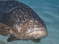
The giant grouper (Epinephelus lanceolatus), also known as the brindle bass, brown spotted cod, or bumblebee grouper and as the Queensland groper in Australia, is the largest bony fish found in coral reefs, and the aquatic emblem of Queensland, Australia. It is found from near the surface to depths of 100 m (330 ft) at reefs throughout the Indo-Pacific region, with the exception of the Persian Gulf. It also enters estuaries.[2] It reaches up to 2.7 m (8 ft 10 in) in length and 400 kg (880 lb) in weight;[2] there are unconfirmed reports of it growing much bigger, up to 1320 pounds. Giant groupers feed on a variety of marine life, including small sharks and juvenile sea turtles. Due to overfishing, this species has declined drastically in many regions, and it is now considered Vulnerable by the IUCN.[1]
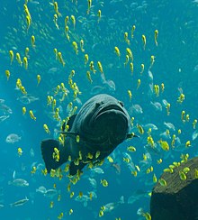
Giant grouper among group of golden trevally at the Georgia Aquarium
This giant fish is similar to the Malabar grouper, and its colour changes with age. The giant grouper has a large mouth and a rounded tail. Juveniles have irregular black and yellow markings, while adults are green-grey to grey-brown with faint mottling. There are numerous small black spots on the fins.
The first fish to undergo chemotherapy was Bubba, a giant grouper at the Shedd Aquarium in Chicago, USA.[3]

Photo

Jelajah Joran 2012 - S02E09

Bay of Islands

Fishing Destination

Bay of Islands

 
Kerikeri, Bay of Islands.
Location of the Bay of Islands.
Dolphin watching in the Bay.
Urupukapuka Island
The Bay of Islands is an area in the Northland Region of the North Island of New Zealand. Located 60 km north-west of Whangarei, it is close to the northern tip of the country.
It is one of the most popular fishing, sailing and tourist destinations in the country, and has been renowned internationally for its big-game fishing since American author Zane Grey publicised it in the 1930s.


[edit] Geography

The bay itself is an irregular 16 km-wide inlet in the north-eastern coast of the island. A natural harbour, it has several arms which extend into the land, notably Waikare Inlet in the south and Kerikeri and Te Puna (Mangonui) inlets in the north-west. The small town of Russell is located at the end of a short peninsula that extends into the bay from the southeast. Several islands lie to the north of this peninsula, notably Urupukapuka Island to the east and Moturoa Island to the north. The Purerua Peninsula extends to the west of the bay, north of Te Puna Inlet, and Cape Brett Peninsula extends 10 km into the Pacific Ocean at the eastern end of the bay.

 History

About 700 years ago, the Mataatua, one of the large Māori migration canoes which journeyed to New Zealand from Hawaiki, was sailed to the Bay Of Islands (from the Bay of Plenty) by Puhi, a progenitor of the Ngāpuhi Iwi (tribe) which today is the largest in the country.[1] Māori settled and multiplied throughout the bay and on several of its many islands to establish various tribes such as the Ngāti-Miru at Kerikeri. Many notable Māori were born in the Bay Of Islands, including Hone Heke who several times cut down the flagpole at Kororareka (Russell) to start the Flagstaff War.
Many of the Māori settlements later played important roles in the development of New Zealand, such as Okiato (the nation’s first capital), Waitangi (where the Treaty of Waitangi would later be signed) and Kerikeri, (which was an important departure point for inland Māori going to sea, and later site of the first permanent mission station in the country). Some of the islands became notable as well, such as Te Pahi Island where 60 of Chief Te Pahi’s people were killed as revenge after he was wrongly accused of being responsible for the Boyd Massacre at Whangaroa.
The first European to visit the area was Captain Cook, who named the region in 1769. The Bay of Islands was the first area in New Zealand to be settled by Europeans. Whalers arrived towards the end of the 18th century, while the first missionaries settled in 1814. The first full-blooded European child recorded as being born in the country, Thomas King, was born in 1815 at Oihi Bay in the Bay of Islands. (There have been unsubstantiated claims that a European girl was born earlier at the Dusky Sound settlement in the South Island).
The bay has many interesting historic towns including Paihia, Russell, Waitangi and Kerikeri. Russell, formerly known as Kororareka, was the first permanent European settlement in New Zealand, and dates from the early 19th century. Kerikeri contains many historic sites from the earliest European colonial settlement in the country. These include the Mission House, also called Kemp House, which is the oldest wooden structure still standing in New Zealand. The Stone Store, a former storehouse, is the oldest stone building in New Zealand, construction having begun on 19 April 1832.
In a 2006 study, the Bay of Islands was found to have the second bluest sky in the world, after Rio de Janeiro.[2]

 The Cream Trip

In 1886, Albert Ernest Fuller launched the "Undine" sailing ship in the Bay of Islands to deliver coal supplies to the islands within the Bay. With the fitting of a motor in the early 20th century, Fuller was able to deliver the coal and essential supplies to communities as far out as Cape Brett.
In 1927 Fuller acquired the "Cream Trip" from Eddie Lane - with the facilities on board to transport cream from the islands, and by the 1960s, the newly commissioned "Bay Belle" started this run. Although a modern catamaran now takes this historical route of the original The Cream Trip, the Bay Belle continues to transport visitors and locals between Paihia and Russell throughout the day.